![]()
- You are here:
-
Home

- Places
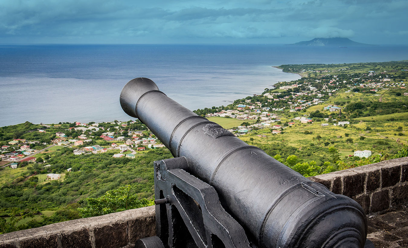
Basseterre

Pierre Belain Sieur D’Esnambuc arrived in St. Kitts in 1625 on a vessel belonging to his comrade, Urbain Du Roissey. They found here a Kalinago community, a few French sailors who had been shipwrecked on the island and were waiting for an opportunity to return to France and a small group of English colonists who had started to cultivate tobacco for export. D’Esnambuc in particular liked the idea of growing a cash crop and after promoting the idea in France, the two men returned to the island the following year with a group of French colonists. In both instances the French landed on the northern side of the island.
On the 13th May 1627, following the routing of the Kalinago community, the island was divided between the two European nationalities. The English took the middle section while the French occupied the northern and the southern extremities. Du Roissey, took charge of Basseterre, the leeward (southern) side of the island. There he built a fort to protect the settlement that was to become the town of Basseterre.
In September a Spanish fleet appeared off Basseterre and eventually landed. Du Roissey prepared to defend his small community but without much success. He then sailed round to Pointe de Sable and convinced the colonists there that they too should leave. Without allies to help them defend the colony, the English surrendered. A small group of French men, lead by D’Esnambuc found refuge in Antigua and awaited an opportune moment to return. Du Roissey, however decided to go back to France.
D’Esnambuc and his companions returned to St. Kitts that same year and he took up residence in the Basseterre quarter, at Fountain. Very gradually the small community started to grow and in 1635, Capucin missionaries were sent out to convert the Kalinago that remained on the island and to minister to the French population. They set up a convent in each of the French quarters with the one in Basseterre being located between the settlement and the Governor’s residence.
D’ Esnambuc died in 1636 and the governorship of the island was placed in the hands of Phillip De Lonvillier De Poincy, Knight of the Order of St. John of Jerusalem, Rhodes and Malta. When La Petite Europe carrying the Knight Governor, arrived in St. Kitts on the 20th of February 1639, the tiny settlement of Basseterre saw the finest spectacle of European grandeur to be displayed in theNew World. The new governor’s retinue of gentlemen and guards in cloaks embroidered with the white eight pointed cross of the Order of St. John, lead a procession to the church of Notre Damewhere the Te Deum was sung and where the planters came forward to ensure him of their loyalty. De Poincy quickly embarked on a number of construction projects. He had come prepared with a number of artisans and skilled personnel. True to his calling as a knight of St. John he built a hospital for visitors who fell ill during their stay on the island and for residents who could not get the care they needed in their own homes. He also made fostering arrangements for orphans at his own expense. A substantial Fort Basseterre, replaced the small Fort Pierre, a fairly large building was constructed as the meeting place for the council and for the conduct of administration.
Cesar De Rochefort’s work Histoire naturelle et morale des iles Antilles de l'Amérique... avec un vocabulaire Caraïbe originally published in 1658 contains a brief description of the town. It was translated in 1666 by John Davis.
Both the English and French settlers on the island were engaged in the planting of crops for export. Most of them had tobacco plantations and employed small numbers of European indentured servants. Among these were a number of Irish Catholics who had either been transported or who had left Ireland lured by the possibility of a better life in the West Indies. Those who were free of indenture chose to settle to the West of Basseterre in what came to be called Irishtown.
Wars and Destruction
In 1666 war broke out between England and France. English Governor Watts on St. Kitts informed his French counterpart of the development. The French General having doubled his guards near Cayon, marched from Basseterre with an army that included enslaved men armed with bills, hoes and firebrands. The fighting took place in the English Quarters and resulted in the French gaining control of the whole island. However the Treaty of Breda signed 1667 restored the original division of the island. The actual restoration took some years to accomplish as the French had made investments in the English part of St. Kitts and were not willing to relinquish it. This led to a great deal of mistrust between the two sides and both attempted to maintain a military presence. In 1672, it was estimated that in the Basseterre quarter there were about 800 musketeers and 100 horse. The town itself had one platform commanding the road with 12 cannon. There were also several sturdy stone houses.
In 1689 the Irish on St. Kitts refused to recognise the substitution of James II who was a catholic with protestant William and Mary. They rose in rebellion and were supported by the French whose war ships attacked Fort Charles in Old Road. The English capitulated and were allowed to go to Nevis. However on the 20th June 1690 British forces landed in Frigate Bay and made their way to Basseterre. The squadron then weighed for Basseterre, which the French evacuated, both forts and town, on our approach, and fled to the mountains. Our army marched on, burning all before them, and in the evening encamped about a mile from the town. (Calendar of State Papers Colonial, America and West Indies, v. 13: 1689-1692 (1901)) Governor Codrington insisted that the English should resettle the island and advocated full control over it. Although a resettlement was accomplished, the English once again gave up the French Quarter of St. Kitts in 1697 at the Treaty of Ryswick. The English settlers vented their anger at this decision by destroying what they could before they left. R. P. Labat described the town in ruins in his Voyages aux Isles de l’Amerique 1693-1705.
England and France were again at war in 1702, this time over who should inherit the Spanish throne. As soon as the news reached Governor Codrington, he marched on the French in St. Kitts. Taken by surprise they surrendered immediately and most were sent to Hispaniola. The Irish who had settled in the Basseterre area had to leave with them. However in 1706, a French fleet put troops ashore on St. Kitts and they spent most of the following week wreaking havoc on the island. The Church of Notre Dame seems to have survived the ravages but was later set on fire by English soldiers. It is not clear if this was arson or an accident.
End of the French Interest
In 1713, the Treaty of Utrecht gave the whole of St. Kitts to Great Britain. In the years preceding the Treaty, much of the land that had belonged to the French had been given to persons who had helped the British. Some of the holders were British, others were French Huguenots, a few were former enslaved persons. There was a great deal of speculation as to what was to become of these grants and any remaining land. Finally all grants were annulled, and in 1726 a Commission of three men was sent to the island with the express purpose of selling the land. Holders tried to make claims before the committee, some even offered to purchase the land that had been granted to them. The committee heard and decided cases individually. The task was difficult because many of the surveys were found to be inaccurate. Among the properties sold were those in the town of Basseterre itself. At the commission’s meeting of the 19th August 1726 it was agreed by general consensus that the construction of thatch and wattle houses would not be allowed in the town.
In 1727 Basseterre stretched between the old French Fort in the East and College Street in the West. The following year th town was described as “the most opulent, and the chief place of trade and business.” It was therefore decided that plans to build a court house in Old Road should be abandoned and that such a building should be constructed in Basseterre. It was built on Church Street. Although wars continued to be fought in the region, St. Kitts seems to have experienced a respite and both trade and agriculture flourished.
The Eighteenth Century
Flourishing trade meant taxable goods and transactions, so following the Seven Years War, (1756-1762) Britain introduced the Stamp Act to recoup some of the costs it had incurred and to protect its new acquisitions in North America. Basseterre erupted in civil unrest in opposition to the act. It was an expression of exasperation felt by mant colonists in the British colonies in the Americas but the people of Basseterre left no doubt as to how they felt about the new taxes.
In 1768 another law adjusted the boundaries again as a significant number of houses, , had been erected outside the old limits of the town. The new boundaries were pushed west towards Fort Thomas. In 1792 Maria Woodley Riddell described a tiny Basseterre in her book Voyages to the Madeira and Leeward Caribbean Isles.
The construction of the Court House in 1792, and the housing of administrative and legal officials in it, contributed to a west ward expansion of the town and the creation of New Town. In 1818 the Council passed legislation to facilitate the draining of the pond on the western edge of town. This procedure did not produce permanent results as legislation had to be passed again in 1894. The McMahon map of 1828 shows housing precariously close to the swamp on Ponds Estate. Despite this in 1825, in his book Six Months in the West Indies Henry Samuel Coleridge described Basseterre as “a large town with many good houses.”
The Post Emancipation Era
The distribution of population on St. Kitts started to change soon after Emancipation with significant numbers moving into town. In 1838 when Apprenticeship was terminated, the labourers on the plantations were no longer bound to work there. Their continued service on depended on the conditions being offered. Kitttian planters continued to allow labourers to occupy estate housing and to grow provisions on estate land but when disagreements occurred ejections often followed and the name of the offender circulated to other estates. Planters used this tactic to eliminate the options of alternative employment for their workers. Lt. Governor Charles Cunningham was aware that this placed labourers at a disadvantage and tried, unsuccessfully, to have the Colonial Office curtail it by law.
For those workers who were ejected from estate land or who wanted to try a different life style there was the option of a move to town or migration. Many chose the former and the population ofBasseterre grew to the extent that the authorities became concerned with poverty and sanitation particularly in Irish Town and New Town. In 1846 a poor house was established and in 1848 a hospital was built mostly through the private efforts of Lt. Governor Cunningham. In 1852 a start was made towards the improvement of the water supply in the town.
In 1854 the island suffered an out break of cholera. In Basseterre alone 1,514 persons succumbed to the disease, most of them in Irish Town and New Town. It was indicative of the dangers of overcrowding. More was to come in 1867 when a fire broke out and consumed most of the town west of New Town and in 1880 congestion in the College Street resulted in many deaths when flood waters carried away buildings. Some of the people in town lived in two storey building but the vast majority occupied “one storey, one room huts built of light material and loosely put together.” Major disasters prompted changes in the layout of the town which included access to a water supply, wider and straighter roads, and protective walls. Eventually the Colonial Administration also intervened by acquiring land to make town expansion possible in the vicinity of Fort Thomas. Visitors James McQuade and William Paton wrote descriptions of the town and its people in their travelogues. Their books denote an air of condescension towards the people of the island and use language that would be considered political incorrect today, yet their descriptions are a valuable source of information.
Basseterre became the centre of administration for two other islands, Anguilla in 1825 and Nevisin 1883. It was a relationship that was rife with bitterness on both sides as Anguillians and Nevisians resented their loss of autonomy while St. Kitts, which was barely weathering difficult economic situations, had additional responsibilities foisted on its strained resources. The purpose of the exercise was to reduce administrative costs and the only beneficiary of the new arrangement was Britain.
As sugar failed to provide a livelihood people started looking elsewhere for work, first in the Windwards, Trinidad and Guyana in the days after Emancipation and then moving further afield to Panama, the Dominican Republic and Bermuda. Basseterre became the port through which passed these mostly seasonal workers, including those from neighbouring islands. The constant comings and goings produced what the authorities called “a bad crowd of loafers.” (see Papers relating to the Disturbances in St. Christopher 1935 p. 4)
Workers from Madeira started arriving in St. Kitts in the mid-19th century. They were brought in to work in the cane fields but some later set up retail businesses in various parts of the island including Basseterre. Another group were the Lebanese who left their country because of violent political unrest. They went straight into business starting out small with a cart full of goods that travelled the country side until they were able to set up shops in town.
The 20th Century
By the middle of the 20th century the Administration, then heavily influenced by the presence of Labour leaders, started looking for opportunities to make land available to the people, where possible for agricultural purposes but also closer to town for improved housing conditions. The habitations of Basseterre expanded into Dorset, Greenlands, Ponds, Birdrock, Shadwell and Wades, and within thirty years the town had extended its boundaries considerably. In the 1990s another type of influx took place with workers from Guyana and the Dominican Republic coming to St. Kitts to cut cane and staying on, many of them in Basseterre. The town is now also the home of a more transient population – students for North America, India, and Africa who are coming to the island to study at the off-shore universities that have established schools here. Many of them live in apartments on the outskirts of town. Down town Basseterre, has become a small but bustling business area with Government agencies, banks, communication companies and small shops. A number of establishments cater of a growing tourist industry. In 1993, the government embarked on a land reclamation project now called Port Zante that created docking facilities and a duty free shopping areas.
Despite its small size, Basseterre has proven to be a town with capabilities matching those of any other in the Caribbean. The town hosted Carifesta VII in 2000, outbidding rivals many times its size. It was even able to outbid the world’s most powerful nation, the United States of America, to host matches for the 2007 Cricket World Cup making St. Kitts and Nevis the smallest country in the world to ever host any World Cup event.
Further reading: Sir Probyn Innis Historic Basseterre (Basseterre 1985)
Salt Pond

English and French settlers started setting up colonies on St. Kitts from 1624. They share the island and agreed to keep the peace unless war was declared by their sovereign nations. The area now called the Salt Ponds was to be used in common.
The very narrow isthmus that connects the Salt Pond area to the main part of St. Kitts was very hilly and heavily wooded making it easier to access the peninsula by sea. .A road down the peninsula was built by the French. Their Basseterre Quarter was contiguous to it and they might have harboured hopes of owning it outright. The value of this real estate can be seen from the fact that the English were willing to give up Brimstone Hill for half of it. At the time, salt was a commodity that made trade possible. Vessels would stop in the small inlets of the peninsula to collect it to preserve food for long voyages. In 1693 and 1694 when the British controlled the area, Deputy Governor Hill incurred the fury of the Nevis Council, because he only allowed “certain people” to collect salt from the ponds.
The Norwood map of 1700 designates the area as “Quartier Maron”. The map by surveyor Pierre Buor (1714) does not show any settlement on the peninsula. This made it an ideal place for runaways to continue to find shelter there. A law passed in 1711 stated that numerous “sundry negroes” who had “withdrawn themselves into the late French Quarter and there absconded themselves in the grounds called the Salt Ponds and in other ground lying to windward of Frigate Bay, with design and intent not only to go over themselves to the enemy, when opportunity shall present but also to persuade and intice other negroes and slaves to go with them.” A law passed in 1722 mentions Johnny Congo, Christopher and Antego Quamina who had armed bands in on the peninsula.
When the French lands were offered for sale starting in 1726, the land of St. Kitts was identified by quality. Good quality land was near water, and fairly level and quite expensive to purchase. Ghauts and mountainsides were considered of inferior quality. The land in the Basseterre area demanded very high prices so the Commissioners who were in charge of the sale had no intention of allowing poor people who could not buy the land to continue to occupy it. A number of poor persons, who had settled on what was considered “valuable” land along College Road, were moved to the Salt Pond which was less valuable. It could not have been a welcome change for them. Their efforts to make a fresh start were hindered by the presence of cattle belonging to people in Nevis. However planters soon found use even for this area.
According to the Baker Map of 1753 the land around the Great Salt Pond was owned by
Earl of Romney, Sir Ralph Payne later Lord Lavington, William Woodley, Richard Holmes, Lt General Gilbert Fleming, All were men involved in administration, some served as governors of the Leewards or locally in St. Kitts. The map shows a small fort at Cockleshell bay. It seems to be located on the Fleming land.
The McMahon map of 1828 shows the land being owned by Romney, J. St. Leger Douglas, William Woodley and Sir Wastel Brisco, the great-grandson of Gilbert Fleming had cane fields, a cotton field, two slave villages and sugar works. The other properties may have been used as pasture.
During this period Rev Daniel Gateward Davis (later Bishop of Antigua) who had been installed as Rector at St. George’s took responsibility for the Salt Pond very seriously. He had a temporary chapel and school erected there. It was established in 1828 as a day school and in 1837 it had one female teacher who taught reading and catechism to around 30 students.
In 1854, John Davy described the use of the Salt Pond in these words:
This lake at the time I saw it, on the 30th of March was about two miles in circuit, surrounded by muddy low ground, occasionally overflowed, and inclosed, except where there is an opening towards the sea, by hills that would have been naked, but for the great flowing aloe, and a bushy prickly mimosa scattered thinly over them. The bottom of the lake being but 6 feet below the sea level, there is a tendency of the sea to flow into it, which is effected in one place through a sand bank by a process of oozing, giving rise to a small salt stream, and in another, in tempestuous weather by the breaking of waves over the intervening low neck of land, which is paved. It is only in seasons beyond the average in regard to dryness that the lake is productive of salt. A strong drying wind of a month’s duration will commonly reduce the water to the point of crystallization. The salt forms at the bottom. It is collected by labourers in punts about eight feet long, and four broad, any by them conveyed to the shore. Occasionally a crust forms like ice at the surface impeding the process. The people employed have half of what they collect for their labour, or rather the price of half, for it is bought on account of the estates to which the lake belongs – thus if the price if the basket is fixed at three pence, three is fixed for each basket. In some years immense quantities have been obtained, and a labourer has made as much as twelve collars a week. The salt is sold chiefly to the Americans.
Salt picking continued well into the 20th century. In most instances it was the kind of work done by persons who were not employed in cutting cane in St. Kitts or picking cotton in Nevis. Most of the workers were Anguillans or Nevisians. When cotton was reintroduced in Nevis at the beginning of the 20th century it allowed Nevisians an opportunity of staying home so that recruitment for Salt picking became dependent on how many workers could find work in the cane or cotton fields. In 1938 an estimated Salt crop of six hundred thousand barrels was predicted. But labour was scarce and labourers were even recruited in Montserrat, Dominica and St. Vincent. The average wage at the time was $5 a week but it was reported that a man from Newtown managed to make $13 per week collecting 20 barrels a day. This was considered exceptional.
Because of its isolation and lack of supervision the area was notorious for smuggling or the manufacture of illicit rum. The Daily Bulletin of the 1 st April 1938 alleged that the area was the ideal place for keeping smuggled goods as government had no means of getting there except occasionally.
I t is well known that continuous smuggling is carried on in Nevis with Salt Pond as the base of operations and that persons concerned in smuggling accept the job of picking salt in order to have access to the coast.
The same new paper had reported on the 28th March 1938 that Cockle Shell Bay was raided and a quantity of liquor seized and taken to Nevis. Another search took place the next day when the raiding party was attacked by about 50 persons. Irving Howell. a young revenue officer was chopped in the back of the head with a machete. Mitchell Williams, a deck hand on the Ursula and Louis Bell also suffered injuries. The rest of the party managed to get Howell and Williams on board the Ursula and to the Alexandra Hospital where they were operated on. A man and woman were arrested. Three persons were arrested and given jail sentences. In 1954 the Daily Bulletin again reported that 5 illicit rum stills had been found at the Salt Pond.
The work of salt picking was back breaking work in the hot sun. It eventually died out.
In 1986 the Government embarked on a venture to cut a road through the peninsula. It was opened in 1989 and named the Kennedy Simmonds Highway. Besides the laying of the road the project included the infrastructure for the supply of electricity, water and cable television to any development that might occur. In an interview for the 25th anniversary of independence Sir Kennedy Simmonds reflected
As those developments progressed we decided we will concentrate on the road. We received some criticism because we did not continue to its logical conclusion. Some people regarded the road and called it the road to nowhere. But you know in developmental terms you cannot regard things in terms of five years or ten years even fifteen years, you have to think in terms of generations and once the infrastructure was provided, we have water under the road, we have electricity, facilities for television, cable, under the road once this infrastructure was in place it did not matter, the fact that they were there would lead to further development in the area
This was the incentive that lead to the development of the Peninsula and more recently to the grand project that is Christophe Harbour. In 2013 at the ground breaking ceremony for the Park Hyatt, Minster of Tourism Ricky Skerritt recognized the early entrepreneurs who had envisioned tourism related development in the area:
Some of you would know that, prior to the construction of the highway into the area, three small hotels operated at various periods on this site. I am therefore taking this opportunity to pay tribute to those entrepreneurs, who such a long time ago shared a vision for resort tourism in this area. I speak of the Bowers family who built a small ten-room hotel on the neighbouring Cockleshell Beach back in the 1970’s, and of Mrs. Margo Schmidt who built a small exclusive hotel here on Banana Bay around the same period. Both of those hotels were accessible only by sea at that time and they operated side by side for about ten years or so before closing because of ongoing financial losses. I also want to pay tribute to Colin Pereira, his family, and their business partners at Ocean Terrace Inn, who later purchased both properties and developed the OTI Banana Bay annex which operated successfully for a few years before it was purchased by the famous Butch Stewart of Sandals in 1988. Unfortunately Sandals never developed the much anticipated resort that Butch and the Government of the day promised to build here, and the site was eventually sold by Sandals at a windfall price to the Christophe Harbour developers in 2007, nearly twenty years later. Nevertheless, I expect that the Bowers, Schmidt and Pereira families would all be pleased to see their tourism dreams for this area being given a major rebirth through this Park Hyatt project.
Spooners Plantation, Cayon

There were two Spooner plantations on St. Kitts. One was in Christ Church and seems to have been known by various names. These notes focus on the one in St. Mary’s.
De Brissac
The land that became Spooner’s seems to have been (at least in part) the property of Captain Paul De Brissac. In 1706 De Brissac, who was probably a French Huguenot, claimed for damage suffered during the French attack of 1705 in which he lost six enslaved workers valued at £204 and cattle and horses worth £203. The invasion had also caused damage to a number of buildings on his plantation. These included his house, a boiling house and still house and a mill. He also claimed for 25 acres of plant canes, 50 acres of ratoons and 8.5 acres of young cane valued at £1129. The claim did not give the exact location of the property. ( Report of the commission to enquire into losses sustained by inhabitants of St. Christopher and Nevis during the French invasion 1706 TNACO243/3 page 458) The Bour map of 1714 shows De Brissac was still the owner of land in the hills in the Cayon area. Paul De Brissac died in 1719 and the plantation became the property of John Spooner soon after.
The Spooners
John Spooner was the first of his family to be connected with St. Kitts. He was Solicitor General, and later Speaker of the Assembly. The earliest mention of him on the island came in Sept 1711, when he and John Pinney were appointed by Governor Walter Hamilton to take evidence from witnesses about complaints against him for a report to the Council of Trades and Plantations. Hamilton described Spooner as
Solicitor General of these islands, and a verry worthy gentleman... he is a person very capable to inform theire Lordships about the state of these islabds, and in particular as to my conduct.
Hamilton went on to recommend that Spooner should be granted land formerly in possession of Governor Douglas. In 1723 the Brissac lands that Spooner had acquired were in dispute. The lands of a Monsieur Salanave, a neighbor of De Brissac, had been granted to Daniel Cunningham. This grant also included some of the Brissac property. A report from the committee of the Privy Council agreed with Spooner's claim and an order-in-council confirmed his ownership of the land.
However in 1726 the Commissioners for the sale of the French Lands arrived in St. Kitts and those holding land in the former French parts of St. Kitts were made to pay for them. On the 24th Aug 1726, Spooner appeared before the Commissioners and offered to buy the plantation in St. Mary’s at the rate of £7 sterling per acre. The Commissioners expected £10 per acre which had been the offer on the adjoining plantation. Spooner asked for time to show that the land was not of the same value as that adjoining it. He also produced a document dated the 16th June 1722 signed by General John Hart (Governor of Leewards 1721-1728) to show his right of possession. This put him in conflict with William Woodley, who was attempting to buy several plantations which may have included the one that had been given to Spooner. Woodley refused to be in the company of Spooner except at public land auctions.
17 Oct 1726 John Spooner appeared before the Commission to settle his accounts but it was noted that the land allotted to him was a little over 78 acres. This was 14 acres more than had been agreed upon. The commission’s surveyor pointed out that six acres of it was steep, rocky and barren. Since the Commission felt that he had been over charged for the rest of the land he had bought, it was agreed that Spooner should only pay 25 shillings per acre for the additional acres. He paid £658 1s 6d for all the land purchased.The commissioners did not insist on any new buildings as ‘sufficient being already erected.’ Spooner seems to have caused a great deal of anxiety for the commission. They were suspicious of his claims and his intention to pay for the land. Despite all this John Spooner became the owner of a plantation in Christchurch. two in St. Mary’s. and one in St. George’s
He died 1758. His will, was written in 1754. The document was dominated by the marriage settlement of his eldest son, John to the heiress Mary Fortescue. (1710 – 1752). The will was not specific about which plantations in St. Kitts formed part of the settlement. The estates in St. Mary and Christ Church St. Kitts ended belonging to his third son, Charles who took his responsibilities seriously.
It was during Charles’ ownership that a hurricane caused a great deal of damage in 1772.
The Water-mill was almost torn to pieces, several other buildings damaged, the dwelling house a little stripped, negro houses mostly, if not all, down and the crop something hurt.
Charles Spooner showed great concern for the survival of the plantation. Some might have been caused by the trauma caused by the Hurricane. His will stated: in case of Hurricanes or violent storm whereby buildings shall be blown down or greatly injured or whereby great damage or destruction shall happen to the same Estates respectively or to the stock thereof to raise by mortgage of the same plantations and estates respectively or other usual ways and means such sums as shall or may from time to time be wanting to repair or make good the damage or destruction so done or happened to the same Estates or the buildings and stock thereof respectively and thereupon to apply such monies so to be raised accordingly and which sums so to be raised are to be raised and paid as herein before mentioned.
In 1817, William Jordon, manager of the properties of Charles Spooner made a return of the enslaved working on the various Spooner estates. It showed a total of 139 workers and those who were able to work were all engaged in plantation duties. There were no house slaves. This meant that the managers had to look after themselves or purchase or rent enslaved workers for their household needs.
Charles ensured that both his wife Mary (nee Burt) and his sister-in-law received annuities from his estates. As he was childless, he left his estate in St. Mary’s to his nephew, Hungerford Spooner.
Hungerford Spooner died in 1819 leaving no legitimate male heir so the estates devolved on the Shaw branch of the family. In 1823 Peter Theodore Shaw and his son Peter Spooner Shaw mortgaged the properties to the firm of Manning and Anderdon Originally, a mercantile firm trading with the West Indies, Manning and Anderdon owned several other estates in St. Kitts and the Caribbean.
Post Emancipation
The years that followed Emancipation in 1834, saw Spooner’s, Cayon passing from one owner to the next.
J W Freshfield sold it to John Hopton Forbes, in trust for William Beckford and John Rankin in 1837.
John Rankin’s heir in 1844 was his niece Janet Davidson from whom the property passed on to William Adam Davidson.
In 1855 Davidson sold it to Nicol Graham Graham to clear his debts. Graham was a colonel resident at Jarbruck, Dumfriesshires, Scotland.
On his death in 1858, the property went to his son Ivan Cunningham Graham then resident in Guernsey.
In 1862 he in turn conveyed it to Francis Wigley and Archibald Paull Burt (the first Chief Justice of Western Australia). They were a legal firm that was becoming involved in plantation ownership.
From Wigley and Burt it passed into the ownership of Mary Hamilton Laing in 1863 (SKNNA St. Christopher Register Series 4, Vol. W, doc 21290). Laing seems to have been the grand-daughter of Thomas Clarke Trotman, owner of Bulkeleys, Carmichaels and Valley estates in Barbados. An indenture drawn up in 1872 between Mary Hamilton Laing and Robert Baxter Rose gave Rose an interest in the property.
In 1876 Robert Baxter Rose sold Spooners to Solomon Abraham Wade. All the changes in ownership could not have been healthy for the estate and its workers. The Rose to Wade sale ushered in a more stable period with regards to ownership but with prices of sugar fluctuating dramatically, the industry itself was in an unpredictable state of affairs.
Wade
Solomon Abraham Wade’s (1801-1881) was the son of Abraham Wade probably of St. Martin and his wife, Frances Paget, the daughter of the Rev Thomas Paget of St. Thomas Middle Island. He seems to have started out in small business which grew into the partnership of Sandall and Wade. Wade also went into plantation ownership
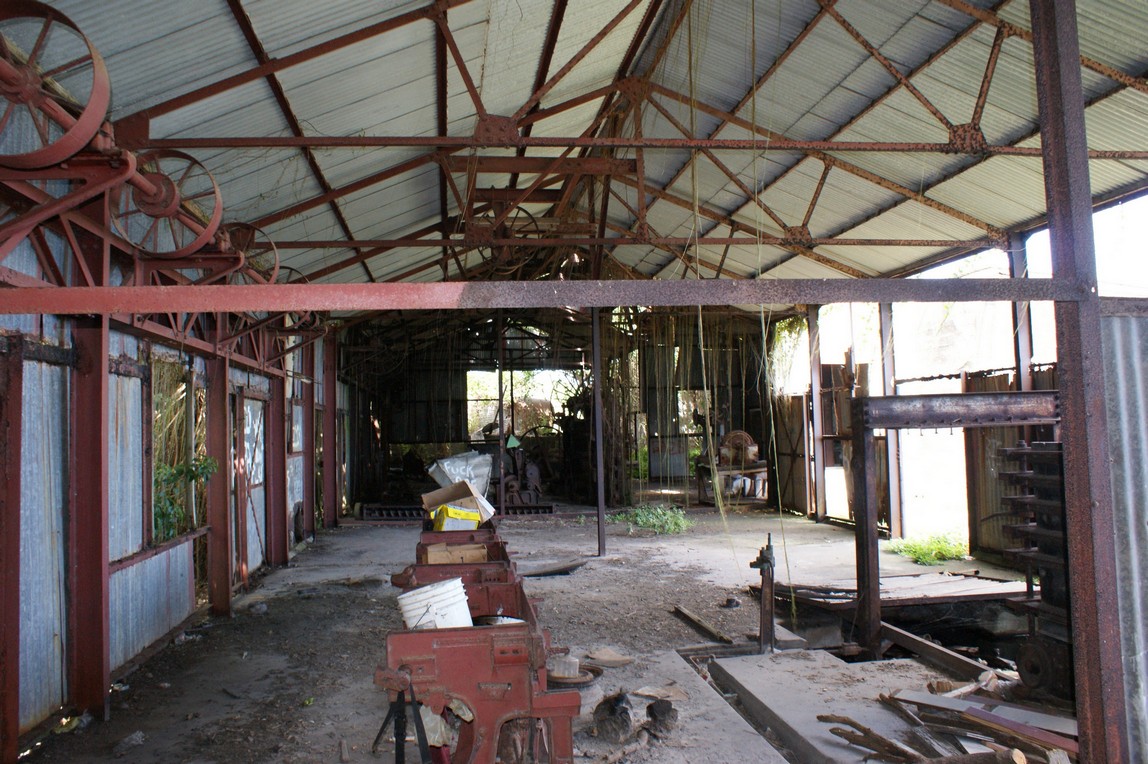
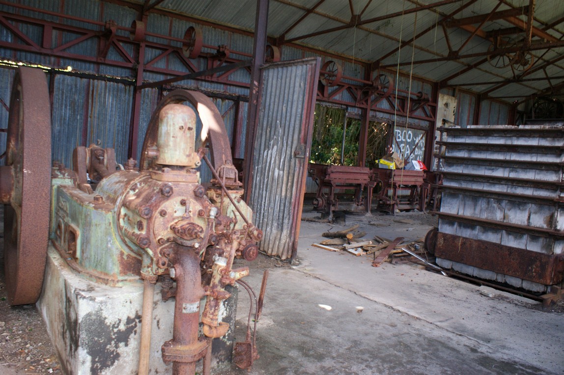
Solomon bequeathed Spooners to his son, Ethelbert whose will passed it on to his brother Paget who converted the sugar factory there to a cotton ginnery in 1901. Amy Wade, his wife continued overseeing the work at Spooners and other Wade estates. Their son Charles Paget Wade inherited most of the estate from her. He was more of an artist than a business man. The death of his mother forced him to pay attention to the management of Wade Plantations, the company created to manage the Wade estates in the Caribbean, and the source of his income.
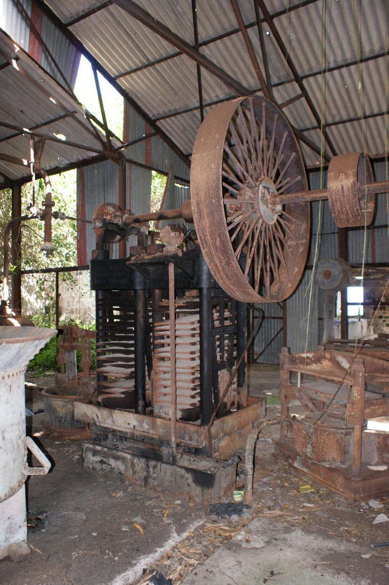
In 1938 the cotton ginnery at Spooner’s was destroyed by fire. Wade Plantations Ltd replaced it with a new ginnery and oil refinery in 1940. The new establishment had 4 gins with a capacity of 1600 lbs lint per working day. Cotton seed was used for making other products. Oil was extracted from the cotton seed. It was refined and sold as cooking oil. More solid fats were manufactured into soap and the remnants of the seeds were turned into fodder for the plantation livestock
In 1950 the wages on the Wade estates were as follows
Cotton
Weeding cotton 88c-$1 per acre
Picking cotton 2.5c per lb
Cleaning cotton 81c pr 100lb
Heaping cotton 27c per acre
Cleaning fields $2.23 per acre
Ginnery male labourers 80c per day
Ginnery female labourers 56c per day
Sugar
Estate male labourers 91c-1.02 per day
Cutters $13.12 per week
Handers $8.13 per week
Packers $1230 per week
Tractor drivers $18.60 per week
Truck drivers $17.36 per week
Estate female labourers 56c-68c per day
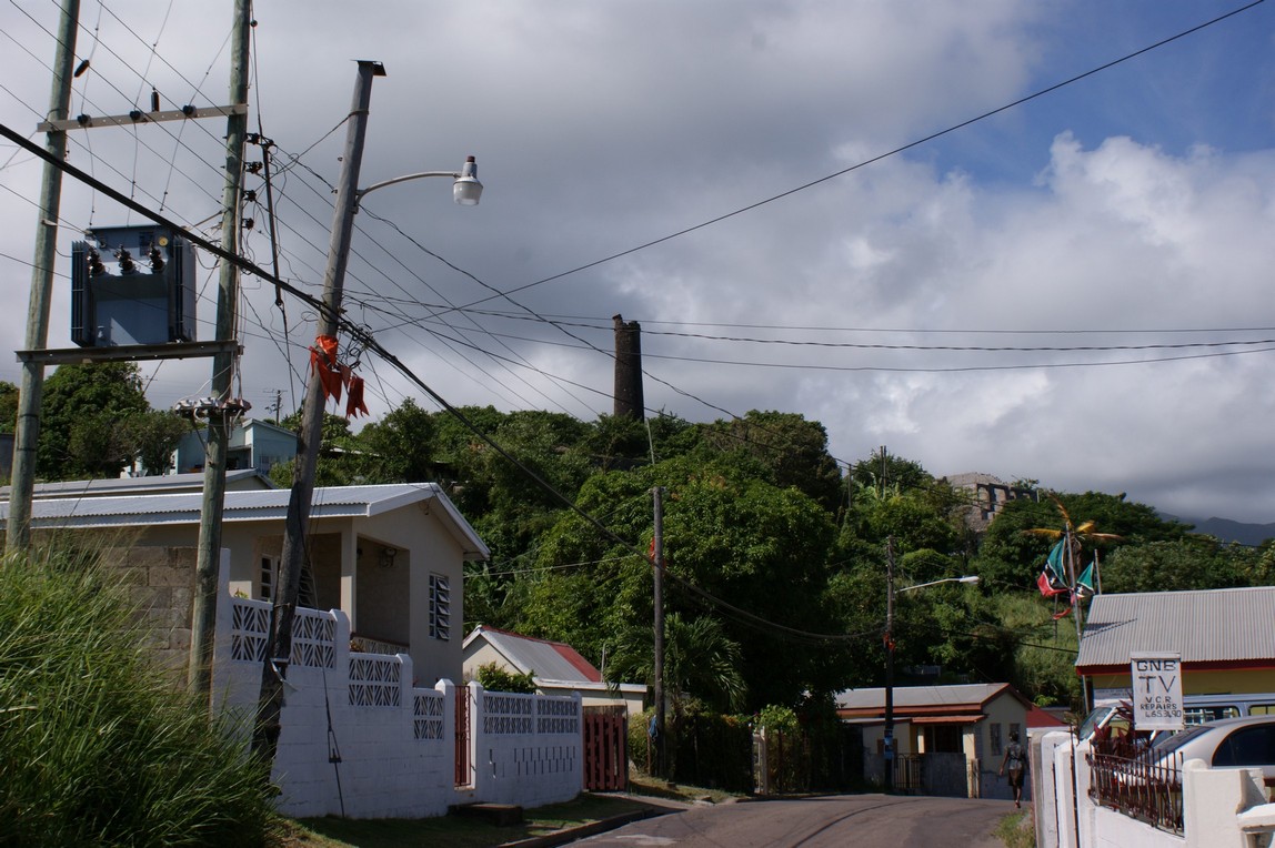
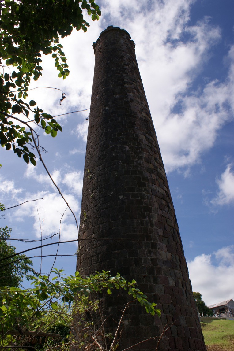
Spooner’s ginnery seems to have been in operation till about 1964 after which date it stopped featuring in the company’s accounts. Spooner’s was one of estates acquired by government in 1975.
National Archives
Government Headquarters
Church Street
Basseterre
St. Kitts, West Indies
Tel: 869-467-1422 | 869-467-1208
Email: NationalArchives@gov.kn
Website: www.nationalarchives.gov.kn
Follow Us on Instagram


Government Headquarters
Church Street
Basseterre
St. Kitts, West Indies
Tel: 869-465-2521 ext.1208
Website: www.nationalarchives.gov.kn
![]()
19 St. Clair Avenue
Port-of-Spain
Trinidad and Tobago
© Copyright 2018 National Archives, St. Kitts Nevis. All rights reserved.
Web Development: Genesis