![]()
- You are here:
-
Home

- Places
The Sugar Factory

From the time of settlement St. Kitts was developed as a plantation island. At first the plantations were small and produced such commodities as tobacco, cotton, and indigo. Over the 17th century sugar cane started gaining ground. It took a while for it to become the main and only crop because it required a great deal more investment than other crops. Sugar estates developed as self-contained industrial complexes, each with its own individual labour force, and sugar works. While the price of sugar remained high, this method turned a profit but when the price dropped, economies had to be made. After Emancipation this would mean cut-backs in the wages of laborers, and the number employed but such a method of economising could not go on indefinitely. The efficiency of the process of producing sugar started taking center stage in the late 19th century.
During the 1890s a terrible slump hit the sugar industry. Workers of St. Kitts and the wider Caribbean found living conditions hard, and at times intolerable. The Portuguese Riots of 1896, in the Basseterre area, were an expression of the frustration felt by many in St. Kitts. The colonial administration realized that economies on individual plantations were no longer the solution. Something more drastic had to be done and talk of a central sugar factory started appearing in the official records. The Norman Commission of 1897 stated
It is generally recognized that in the present day the production o sugar can be most economically carried on in large central sugar factories, equipped with the best machinery, the management o the cultivation of canes being conducted separately from that of the manufacture of sugar. In some places it is found most economical that farmers should grow the canes independently and sell them to the central factory.
The Central sugar factory on St. Kitts was built or as it was said at the time, “thrown together” during 1910 and 1911. Andrew Love of the Mirrlees Watson Company Ltd out of Glasgow, Scotland was in charge of its construction. Frank Kortright supervised the construction of the pier and the railway. G F D Duncan kept an eye on things for the company, M S Moody Stuart was in charge of general business arrangements. There was a large labour force of Kittitian workers who were supervised by Tapley Seaton (stevedore and livery stable owner), C Y Connell, J B Simmonds, and H G Audain.
The construction encountered a number of problems. There were no tugs in the harbor and only three lighters could deal with the weight of the rollers carrying one each. A special raft had to be built to land the lattice grinders. Each one weighed 6 tons and was 50 feet long, 4 feet deep and 1 foot 3 inches wide and there was no vessel in St. Kitts or neighboring islands that could handle their size. Labourers worked on the Mill foundation day and night till it was completed with only small concrete mixers available for the job.
On the 20th February 1912, the factory was officially opened by Mrs. Moody Stuart. There were both British and local share holders in the new enterprise. This marked the change from the old muscovado mills on the estates to a modern central operation under the name St. Kitts (Basseterre) Sugar Factory. A whole complex developed around the factory providing accommodation for management and middle management. It became the largest employer on the island. From 1940 onwards, negotiations between factory management and the St. Kitts-Nevis Trades and Labour Union were an important factor in the management of personnel in the industry.
A club was set up in 1950. In 1959 the wooden building that housed it was demolished and a new concrete structure was erected. It had a concert hall that could seat up to 400 persons but it was generally felt that only the elite could attend functions held there. The Welfare Centre consisted of a canteen, bakery, barber shop, launderette and ice plant. It also had a shower room with hot and cold running water.
The Factory was a training ground for skilled tradesmen on the island. The work produced in its workshops was so accurate that, from time to time, replacement parts for airplanes were ordered when they could not be readily obtained. Eventually an apprenticeship scheme was introduced through which boys aged 16 to 18 could sit a test and on passing would be taken on as apprentices for five years. They were given hands-on experience in workshops and taught English, Mechanical Drawing, Math and Science. Some of these young men eventually set up their own businesses.
In 1972 a report on the sugar industry highlighted the urgency of improving productivity. It recommended that a central company should be set up to run an integrated industry run by private investors and Government. The London interests preferred opted to sell its shares to Government as it was not interested in becoming a minority shareholder. After lengthy negotiations, on the 17th December 1976, the factory, the land it was on, the machinery some of which needed replacing, and the railway were sold to Government for the price of one million pounds.
The acquisition by government of the factory and the estates was intended to keep the sugar industry alive and facilitate continued employment. However the conditions that had caused the decline persisted, and when the price of sugar would not recover a decision was finally made to close the industry in July 2005.
The Bungalow - Newton Ground

In 1920, Charles Wilton Wood Greenidge who had come from Barbados to serve as a magistrate tried again. A young man of 31, he must have found St. Kitts a quiet place with lots of potential for enterprise. Soon after his arrival, he had acquired Brotherson’s estate and he envisioned the estate becoming the location of a second sugar factory with shipping to take place in the vicinity as well. The Bungalow at Newton Ground was to become part of that complex. It was immediately pointed out to him that a Magistrate could not promote private companies. Greenidge believed in the enterprise so much that he resigned his post.
He had not been the first to think of such a project. Long before the Basseterre Sugar Factory was built in 1912, the man who would become its first General Manager, George Moody Stuart had suggested that a factory should be built at the northern end of the island. He saw this as a way to aid the development of the area between Sandy Point and Dieppe Bay. There was support for this idea at first but at the last minute a number of estates withdrew. When the factory at Kittstoddarts was built, attempts were made to link the northern district to it by boat and then by rail. In September 1919, the New York firm of F C Lothi and Co revived the proposal but once again the scheme did not materialize as the company could not float enough capital to erect the factory.
Greenidge’s new company, The St. Kitts Capisterre Co-operative Sugar Factory, was registered in the Leeward Islands with a nominal capital of £60,000 and was to be owned by owners of estates contracting for the supply of cane. Its factory was to produce 5000 tons annually produced by a 14-roler-mill made by Mirrlees of Glasgow.
On the 15th September 1920 the company invited applications for the issue of £40,000 in debentures under the provisions of its articles of association to raise the required funds to build its factory and railway. Subscribers included Burchel Marshall, (see document) J D Cardin, Virginia Ryan, Edwin Dinzey, Stedman Moir, Marjorie Clegg, Elizabeth Dias and members of the Manchester, Branch, Dobridge, Matheson and Yearwood families. Despite the support, the company did not make it and was soon in liquidation.
Greenidge resumed his legal career and was appointed magistrate in Barbados in 1923, rising to the position of Judge of the Court of Appeal. He also served in Trinidad, Honduras and Nigeria and in 1947 he was appointed to the United Nations ' Ad Hoc Committee of Experts on Slavery 1950-51. When not traveling on work related matters, he in Barbados, with a second home in Malta
Bayfords Estate

This estate is in the Parish of St. Peters, in the hills above Basseterre. Its first known owner was Thomas Bridgewater. At the time of the sale of the French lands on St. Kitts, Bridgewater was already in occupation of the estates but had to pay the Commissioners for it in 1726. The plantation then consisted of approximately 84 acres. At the time of bidding Bridgewater had 28 acres under new cane, 12 acres of ratoon cane, 15 acres of guts and broken land some planted in provisions, and 6 acres unplanted. Pastures, the dwelling house and the boiling house and its complex occupied another 15 acres. The house measured 36 by 12 feet, was boarded and shingled, the boiling house was about 30 feet long, half shingled and half thatched. He proposed to build a proper still house on it within 18 months of purchase. He offered eight pounds sterling per acre for 72 acres of cane land and 5 pounds per acre for the remainder.
Thomas Bridgewater of St. Peters had been a member of the Nevis Assembly in 1710 and Chief justice in 1715. On his death in 1744, property passed into the hands of Dr. George Irwin who had married, Bridgewater’s daughter, Susannah. By 1753, the estate belonged to Richard Rowland and was known as Rowland Hill. Rowland had married Margaret, another of Bridgewater’s daughters. It is not clear why the estate changed hand but a later document suggests that Irwin had amassed a considerable amount of debt and this could have been the reason for the change in ownership. Rowland’s will dated 10 June 1761 he left the property to his daughter Margaret. She married David Bayford, whose name is still associated with the estate.
A description of the damage caused by the hurricane of 1772, shows what buildings and works were on the estate.
Three westward chambers and shed of the mansion house quite down and two chambers damaged; Mr. Frank Rowland's hall and two chambers demolished, kitchen, pantry and wine room irreparable; the hot house, mule pen, cattle pen, mill house, trash house, overseer's house of two chambers, shead, two shead rooms and hall all in ruins; stable, boiling house, curing house and still house very much damaged; nine mules and one bull killed; four acres of canes of this year’s crop and six of next year quite destroyed; ten hhds of sugar lost in the snow Thistle, Capt. Hunter.
In 1802 Margaret Bayford conveyed the property to Clement Caines but she was still noted as the owner when the McMahon map of 1828 was created. It could be that the arrangement had fallen through.
In 1817 William Wharton Rawlins, Son-in-law to Margaret Bayford, trustee for the estate made a return that included 362 enslaved workers. These were probably at Bayfords and the family’s other property Walk Estate. The majority of the enslaved were born in St. Kitts and worked as plantation labourers or trades men. Very few were household servants. At the time of the return, the oldest person on the estate was ninety year old Betty Burt, a creole of Nevis who had been superannuated. The youngest was a one month old girl called Kitsey Addams.
In 1834, John Bayford (Son of Margaret Bayford) was awarded £307 15s 8d for the enslaved at Bayfords and £5046 11s 3d for the enslaved at The Walk while Harriette Bayfords (daughter of Margaret Bayford) was awarded £307 15s 8d for the enslaved at Bayfords
Between 1849 and 1852 James H Bayford and Augustus A F Bayford assigned the land to James Udall for 500 years.
Solomon Wade acquired Bayfords in 1861. That same year the plantation received five labourers (two adult males, two adult females and a boy) from the group of Indian immigrants. Wade sold the property again in 1871.

J. A Branch bought/leased the property (date not found) and on the 21 st Sept 1871 at his request Solomon Abraham Wade assigned it and released it to William Brownbill. The Brownbill family continued to own Bayfords till 1948 when it was acquired by government from Thomas Brownbill.
The land was acquired by the Bayfords Acquisition Act of 1943 and included both Rowland Hill (72 acres) and Blois (88 acres) estates. The government estimates for 1943 show that Government had started running a stock and Dairy Farm. Under Scheme D 186 a grant of £7723 was made available to the Administration for the setting up of a dairy farm with the immediate objective of making the island less dependent on imported condensed milk. It was also intended to develop the farm as an educational centre in dairy management and for breeding of small stock for distribution in St. Kitts, Nevis and Anguilla. A manager, overseer and 2 stock men were employed.
By 1956 Government had 143 cattle at Bayfords and In 1961 Bayford’s produced 21,764 gallons of milk. Of this amount, 3635 gallons were used by the Cunningham Hospital and the rest sold to private homes. The farm was also producing cattle and pigs for slaughter and for breeding purposes. From time to time the stock was refreshed with the purchase of cattle from abroad. For example, in 1970 Minister W F Glasford and Vet Dr. A Vaughan went to the Dorado Farms in Puerto Rico to acquire cattle to enhance the herd at Bayfords. They purchased 6 heifers and 2 bulls of the Holstein Frisians breed. The animals arrived in St. Kitts by charter flight of Seagreen Air Transport on Friday 6th Nov at 4.00pm
In 1984 an attempt was made to put the enterprise on a better commercial footing. It was to provide milk, cheese, yogurt, butter, ice-cream and flavoured milk drinks for local consumption and for the hotel industry. School children were to be provided with fresh milk on a daily basis. Repairs to the buildings and refurbishment of the equipment was undertaken. However the maintenance of the infrastructure and waste continued to be a problem so that in 1990 a task force recommended the privatization of the enterprise.
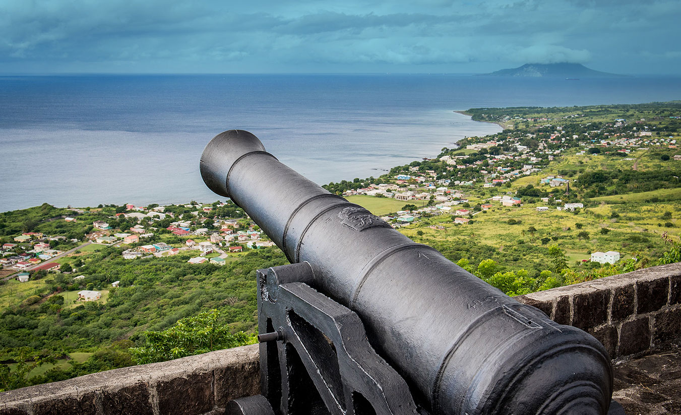
Mount Liamuiga

Mount Liamuiga is a stratovolcano which forms the western part of Saint Kitts . This type pf volcano has a steep conical shape made up of many layers of lava, pumice and ash. Liamuiga rises to the height of 1156 meters or 3792 feet making it the highest peak in the Leeward Islands and one of the highest in the Caribbean islands. It has a crater lake at its peak. Its upper slopes are covered with dense tropical rain forest. The last verified eruption occurred 1800 years ago.
At the time of European settlement, the mountain was called Misery, a reflection of the hardship of life in the tropics for the unprepared Europeans who first settled the island and for the enslaved Africans who worked the land that surrounded it.
The first plantations in its vicinity were developed along the coastline by French settlers. The mountain must have seemed distant and inaccessible. Its remoteness, its ancient impenetrable vegetation, its steep crevasses and its cloud cover must have inspired visions of freedom among those who labored in its looming shadow. In November 1639, the first recorded act of mass marronage in the French Caribbean took place in Capisterre. Sixty enslaved Africans, having had enough of their working and living conditions, made their way up its slopes and found refuge in an area accessible only by a narrow pass. They were eventually recaptured but the survival of one of them for a longer period of time became legendary.
Through the 18th century the cane plantations crept up the slopes of the mountain as sugar became a profitable commodity for those with capital to invest. Only the higher elevations of Misery remained unclaimed. And yet, other runaways found refuge there. In 1834, on the eve of Emancipation it had been home to another runaway known as Marcus “King of the Woods”, for at least three years. He was so notorious that planters feared their newly freed workers would join him and wreak more havoc on the countryside. Soldiers were sent in to find Markus. Although he was sighted a number of times, he was not captured.
Today Mt. Liamuiga stands as a challenging land mark that attracts hikers and nature lovers in search of an exciting climb to its crater.
Challengers

Challengers Is a village in the Parish of Trinity. It was a rather small estates on sloping ground that once belonged to John Challenger. Challenger also owned a plantation in the Parish of St. Thomas, called New Invention. In his will he divided his property between his four sons and one daughter. To his son Clement, he left the small property he had in Trinity as well as one thousand pounds and 5 slaves.
Clement Challenger did not marry but had children with Hester Osborn his house keeper. These were John, Richard and Clementina. In his will, written in 1832, he left this land to his son John. Right away, his heirs had to use a property in Basseterre to deal with the debt that Clement had at the time of his death. John went on to borrow £200 from James Ewing and William Mathieson, merchants of Glasgow.
Visitors who came to St. Kitts in 1840 were told by John that he was selling or renting small lots to individuals who wanted to live there.
“Forming what they call an independent village; that is a settlement not under the control of planters, as the little villages in which the laboring classes reside, generally are. He remarked that he had been censured by the proprietors of estates in his neighbourhood. The fear of drawing from under their control the labourers who locate in them, appears to be the ground of their opposition.” (Narrative of a Visit to the West Indies: In 1840 and 1841 By George Truman, John Jackson, Thomas Bedford Longstreth (Philadelphia, 1844) )
The authors of this publication were Quakers and although they deny wanting to investigate the effects of Emancipation in the islands, their writing alludes to it constantly. It is not clear if John Challenger was feeding this need or whether he really intended to sell and rent in small lots to labourers. Financial problems continued to plague John and his wife Sarah Maria. A piece of land of four acres could not be cultivated as cane land unless it was being worked with another estate or simply produced cane for processing elsewhere. The land in Trinity was therefore sold off to the six persons including John’s sister Clementina. Rent is not recorded in the Christopher Register but sales of lands are and except for the earlier agreement with Cluckies, no records could be found of Challenger selling small lots. The sales found were as follows:
· By Indenture of 18 January 1848 to Elizabeth Jackson Calfe, spinster for £25 sterling, in her actual possession, land lying in parish of Trinity bounded to the east with lands of John Hazell deceased, to the west with lands of John Challenger, to the north with the high road leading around the island and to the south with the seashore. 125 feet east to west and 300 feet north to south (Doc no. 20413 and 20414)
· By Indenture of 1 March 1848 to Thomas James, Wesleyan Missionary. For £85 11s 6d sterling or $410 75c local money - All that parcel of land situate in parish of Trinity bounded to the north with the high road, leading around the island, to the south with the seashore to the east with lands of John Challenger and to the west with the lands of stone fort estate of Daniel B Garling measuring 320 feet east to west and about 300 feet north to south a part of which said premises is now in the tenancy of John James Philips (Doc number 20363).
· Indenture of 10 June 1848 to Ann Susanna Cox Amory spinster for £20 sterling land in parish of Trinity bounded to the east with land of Elizabeth Jackson Calfe, to the west by land of John Challenger to the north by the high road leading around the island to the south by the seashore measuring 30 feet east to west and 300 feet north to south (Doc no. 20422 and 20423)
· By Indenture of 24 June to Clementina Challenger spinster for sum of £35 18s sterling land in parish of Trinity bounded to the east with lands of Ann Susanna Cox Armory to the west with lands of John Challenger to the north with the high road leading around the island to the south with the seashore measuring 75 feet east to west and 300 feet north to south (Doc no. 20417 and 20418)
· By Indenture of 7 Nov 1848 to George Liverpool planter for sum of £20 16s 8d sterling land in Trinity bounded to the east with land of Clementina Challenger to the west with lands of John challenger, to the north with the high road, and to the south with lands of John Challenger 30 feet east to west and 100 feet north to south. (Doc no 20415 and 20416).
Indenture of 27 February 1849 to William Clukies. William Clukies had agreed to advance and lend of Challenger the further sum of £83 6s 8d in addition to the sum of £275 sterling for a Lot of land in Parish of Trinity containing by estimation two acres bounded to the east in part by lands formerly of John Challenger now of George Liverpool and in part by lands of Clementina Challenger to the west by lands of John Challenger at present mortgaged to the Rev Thomas James to the north by the High road to the south by the sea
Another document drawn up on the 27 February 1849 between John Challenger, and Alexander John Cock merchant shows Challenger indebted to Cock in the sum of £42 8s 8d sterling and using his household furniture as security. (Doc no 20421)
It was through the financial distress of one family that Challengers became the first “free” village in St. Kitts.
National Archives
Government Headquarters
Church Street
Basseterre
St. Kitts, West Indies
Tel: 869-467-1422 | 869-467-1208
Email: NationalArchives@gov.kn
Website: www.nationalarchives.gov.kn
Follow Us on Instagram


Government Headquarters
Church Street
Basseterre
St. Kitts, West Indies
Tel: 869-465-2521 ext.1208
Website: www.nationalarchives.gov.kn
![]()
19 St. Clair Avenue
Port-of-Spain
Trinidad and Tobago
© Copyright 2018 National Archives, St. Kitts Nevis. All rights reserved.
Web Development: Genesis