
English and French settlers started setting up colonies on St. Kitts from 1624. They share the island and agreed to keep the peace unless war was declared by their sovereign nations. The area now called the Salt Ponds was to be used in common.
The very narrow isthmus that connects the Salt Pond area to the main part of St. Kitts was very hilly and heavily wooded making it easier to access the peninsula by sea. .A road down the peninsula was built by the French. Their Basseterre Quarter was contiguous to it and they might have harboured hopes of owning it outright. The value of this real estate can be seen from the fact that the English were willing to give up Brimstone Hill for half of it. At the time, salt was a commodity that made trade possible. Vessels would stop in the small inlets of the peninsula to collect it to preserve food for long voyages. In 1693 and 1694 when the British controlled the area, Deputy Governor Hill incurred the fury of the Nevis Council, because he only allowed “certain people” to collect salt from the ponds.
The Norwood map of 1700 designates the area as “Quartier Maron”. The map by surveyor Pierre Buor (1714) does not show any settlement on the peninsula. This made it an ideal place for runaways to continue to find shelter there. A law passed in 1711 stated that numerous “sundry negroes” who had “withdrawn themselves into the late French Quarter and there absconded themselves in the grounds called the Salt Ponds and in other ground lying to windward of Frigate Bay, with design and intent not only to go over themselves to the enemy, when opportunity shall present but also to persuade and intice other negroes and slaves to go with them.” A law passed in 1722 mentions Johnny Congo, Christopher and Antego Quamina who had armed bands in on the peninsula.
When the French lands were offered for sale starting in 1726, the land of St. Kitts was identified by quality. Good quality land was near water, and fairly level and quite expensive to purchase. Ghauts and mountainsides were considered of inferior quality. The land in the Basseterre area demanded very high prices so the Commissioners who were in charge of the sale had no intention of allowing poor people who could not buy the land to continue to occupy it. A number of poor persons, who had settled on what was considered “valuable” land along College Road, were moved to the Salt Pond which was less valuable. It could not have been a welcome change for them. Their efforts to make a fresh start were hindered by the presence of cattle belonging to people in Nevis. However planters soon found use even for this area.
According to the Baker Map of 1753 the land around the Great Salt Pond was owned by
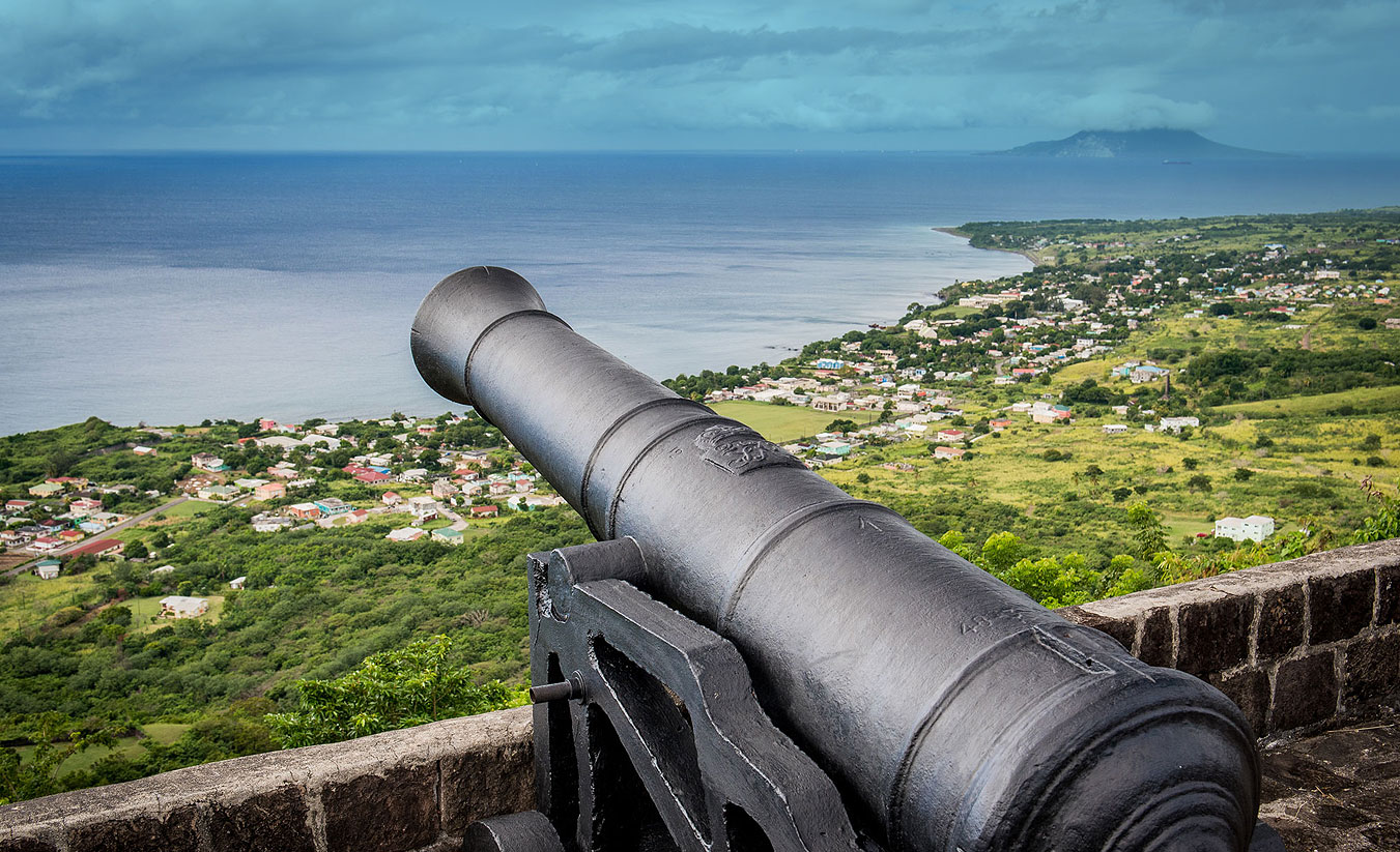
Earl of Romney, Sir Ralph Payne later Lord Lavington, William Woodley, Richard Holmes, Lt General Gilbert Fleming, All were men involved in administration, some served as governors of the Leewards or locally in St. Kitts. The map shows a small fort at Cockleshell bay. It seems to be located on the Fleming land.
The McMahon map of 1828 shows the land being owned by Romney, J. St. Leger Douglas, William Woodley and Sir Wastel Brisco, the great-grandson of Gilbert Fleming had cane fields, a cotton field, two slave villages and sugar works. The other properties may have been used as pasture.
During this period Rev Daniel Gateward Davis (later Bishop of Antigua) who had been installed as Rector at St. George’s took responsibility for the Salt Pond very seriously. He had a temporary chapel and school erected there. It was established in 1828 as a day school and in 1837 it had one female teacher who taught reading and catechism to around 30 students.
In 1854, John Davy described the use of the Salt Pond in these words:
This lake at the time I saw it, on the 30th of March was about two miles in circuit, surrounded by muddy low ground, occasionally overflowed, and inclosed, except where there is an opening towards the sea, by hills that would have been naked, but for the great flowing aloe, and a bushy prickly mimosa scattered thinly over them. The bottom of the lake being but 6 feet below the sea level, there is a tendency of the sea to flow into it, which is effected in one place through a sand bank by a process of oozing, giving rise to a small salt stream, and in another, in tempestuous weather by the breaking of waves over the intervening low neck of land, which is paved. It is only in seasons beyond the average in regard to dryness that the lake is productive of salt. A strong drying wind of a month’s duration will commonly reduce the water to the point of crystallization. The salt forms at the bottom. It is collected by labourers in punts about eight feet long, and four broad, any by them conveyed to the shore. Occasionally a crust forms like ice at the surface impeding the process. The people employed have half of what they collect for their labour, or rather the price of half, for it is bought on account of the estates to which the lake belongs – thus if the price if the basket is fixed at three pence, three is fixed for each basket. In some years immense quantities have been obtained, and a labourer has made as much as twelve collars a week. The salt is sold chiefly to the Americans.
Salt picking continued well into the 20th century. In most instances it was the kind of work done by persons who were not employed in cutting cane in St. Kitts or picking cotton in Nevis. Most of the workers were Anguillans or Nevisians. When cotton was reintroduced in Nevis at the beginning of the 20th century it allowed Nevisians an opportunity of staying home so that recruitment for Salt picking became dependent on how many workers could find work in the cane or cotton fields. In 1938 an estimated Salt crop of six hundred thousand barrels was predicted. But labour was scarce and labourers were even recruited in Montserrat, Dominica and St. Vincent. The average wage at the time was $5 a week but it was reported that a man from Newtown managed to make $13 per week collecting 20 barrels a day. This was considered exceptional.
Because of its isolation and lack of supervision the area was notorious for smuggling or the manufacture of illicit rum. The Daily Bulletin of the 1 st April 1938 alleged that the area was the ideal place for keeping smuggled goods as government had no means of getting there except occasionally.
I t is well known that continuous smuggling is carried on in Nevis with Salt Pond as the base of operations and that persons concerned in smuggling accept the job of picking salt in order to have access to the coast.
The same new paper had reported on the 28th March 1938 that Cockle Shell Bay was raided and a quantity of liquor seized and taken to Nevis. Another search took place the next day when the raiding party was attacked by about 50 persons. Irving Howell. a young revenue officer was chopped in the back of the head with a machete. Mitchell Williams, a deck hand on the Ursula and Louis Bell also suffered injuries. The rest of the party managed to get Howell and Williams on board the Ursula and to the Alexandra Hospital where they were operated on. A man and woman were arrested. Three persons were arrested and given jail sentences. In 1954 the Daily Bulletin again reported that 5 illicit rum stills had been found at the Salt Pond.
The work of salt picking was back breaking work in the hot sun. It eventually died out.
In 1986 the Government embarked on a venture to cut a road through the peninsula. It was opened in 1989 and named the Kennedy Simmonds Highway. Besides the laying of the road the project included the infrastructure for the supply of electricity, water and cable television to any development that might occur. In an interview for the 25th anniversary of independence Sir Kennedy Simmonds reflected
As those developments progressed we decided we will concentrate on the road. We received some criticism because we did not continue to its logical conclusion. Some people regarded the road and called it the road to nowhere. But you know in developmental terms you cannot regard things in terms of five years or ten years even fifteen years, you have to think in terms of generations and once the infrastructure was provided, we have water under the road, we have electricity, facilities for television, cable, under the road once this infrastructure was in place it did not matter, the fact that they were there would lead to further development in the area
This was the incentive that lead to the development of the Peninsula and more recently to the grand project that is Christophe Harbour. In 2013 at the ground breaking ceremony for the Park Hyatt, Minster of Tourism Ricky Skerritt recognized the early entrepreneurs who had envisioned tourism related development in the area:
Some of you would know that, prior to the construction of the highway into the area, three small hotels operated at various periods on this site. I am therefore taking this opportunity to pay tribute to those entrepreneurs, who such a long time ago shared a vision for resort tourism in this area. I speak of the Bowers family who built a small ten-room hotel on the neighbouring Cockleshell Beach back in the 1970’s, and of Mrs. Margo Schmidt who built a small exclusive hotel here on Banana Bay around the same period. Both of those hotels were accessible only by sea at that time and they operated side by side for about ten years or so before closing because of ongoing financial losses. I also want to pay tribute to Colin Pereira, his family, and their business partners at Ocean Terrace Inn, who later purchased both properties and developed the OTI Banana Bay annex which operated successfully for a few years before it was purchased by the famous Butch Stewart of Sandals in 1988. Unfortunately Sandals never developed the much anticipated resort that Butch and the Government of the day promised to build here, and the site was eventually sold by Sandals at a windfall price to the Christophe Harbour developers in 2007, nearly twenty years later. Nevertheless, I expect that the Bowers, Schmidt and Pereira families would all be pleased to see their tourism dreams for this area being given a major rebirth through this Park Hyatt project.

