discover us for yourself
![]()
Discover
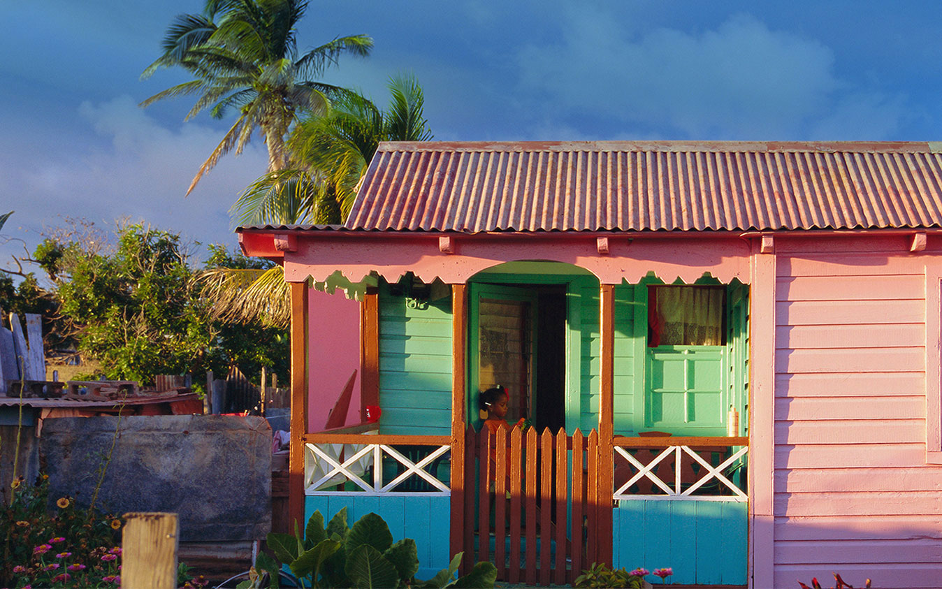
the stories of our proud and friendly people, our charming and colourful villages, our fascinating ruins, our intriguing rain forests,
and our traditions that span centuries.
Our People

Sir Paul Southwell
Caleb Azariah Paul Southwell Caleb Azariah Paul Southwell was born in Dominica on the 18th July 1913 to Joseph and Amelia Southwell. He attended elementary school and became a teacher at the age of thirteen years then he went on to obtain the Leeward Islands Teachers Certificate. In 1938 he joined the Leeward Islands Police Force, a job that took him to Antigua, Montserrat, St. Kitts and Nevis. He stayed with the Force for six years. In...
Read more
Ralph B Cleghorn
Ralph Cleghorn was a free coloured who was born in St. Kitts. Robert Cleghorn, his white father sent him to England at age five to acquire an education. Shortly after he returned to the island in 1823 at the age of 18, his father died at sea. Ralph returned to England to conclude some business arrangements and made his way back to St. Kitts two years later. He married Maria Berkeley, a free coloured woman...
Read more
Selwyn MacDonald 'Lalaps' Liddie
Selwyn MacDonald 'Lalaps' Liddie Selwyn MacDonald “Lalaps” Liddie was born on the 28th January 1912. His father was George Whattey and his mother was Emily Liddie of Irish Town, Basseterre. At an early age he learnt the artistry of the kettle drummer, and soon became an lead clown dancer and a troupe organiser. Lalaps childhood took place in a St. Kitts that offered very few chances of advancement to the working class person. The sugar estate dominated...
Read moreOur Places

Buckley’s Estate
BUCKLEY’S ESTATE is located on the western outskirts of Basseterre. In 1753 the plantation was the property of William Buckley. His only surviving daughter and heir Jeannette married Abednego Matthew (b. 1724). He was the son of William Mathew who in 1715 had been appointed Lieutenant-General of the Leeward Islands and from 1735 was Captain-General and Commander-in-Chief. His ancestors included other governors of St. Kitts and the Leeward Islands. When Jeannette Mathew inherited the plantation from...
Read more
Bloody Point
Bloody Point is situated to the west of Challengers Village. It gets its name from the Massacre of the Kalinago that took place in the vicinity. English and French settlements had been set up on St. Kitts in 1624 and 1625. From the start, Warner and his men treated the Tegreman and his people as hostiles. When they set up their settlement “near to ye kings (Tegreman’s) house” they did not simply build homes, they also...
Read moreVambell Estate
Vambell Estate near Sandy Point but actually in the Parish of St. Thomas, takes its name from its earliest known owner Peter van Belle. The estate was located in the English quarter of St. Kitts. Van BellePeter van Belle was born in Province of Holland now part of the Netherlands probably in the 1640s. Very little is known of his early life. With his brother Joshua, he became involved in the Asiento de Negros. This was...
Read moreOur Events
Disasters in Basseterre
Hurricanes Wars were not the only dramatic events to effect the development of Basseterre. Natural disasters played a very significant roll.The 1642 and 1667 hurricanes destroyed all the houses on the island. In 1667 French Governor Laurent reported I hold myself obliged to inform you that this island is in the most deplorable state that can be imagined and that the inhabitants could not have suffered a greater loss, or been more unfortunate except they had...
Read more
The Fire of Basseterre – 3 July 1867
On the night of the 3rd July 1867, one of the worst fires in St. Kitts destroyed the town of Basseterre. It started in an uninhabited house in Reeve Alley just behind the western side of the Pall Mall Square (now Independence Square). That side of the Square was destroyed. The Alley connected the Square and Fort Street and the fire made its way down both sides. The night was a breezy one and the...
Read more
Treaty of Basseterre 18 June 1981
Treaty of Basseterre Historical BackgroundThe idea of unification within the Caribbean region gained the interest of the British Colonial Office in the late nineteenth Century mostly as a colonial administrative device designed to cut the cost of managing the colonies with failing economies and a growing reliance on Britain. The 20th century however saw a growing discontent with regards to the unrepresentative nature of the island governments. In 1914, T. Albert Marryshow of Grenada, founded the Representative...
Read more"In this bright future, you can't forget your past"
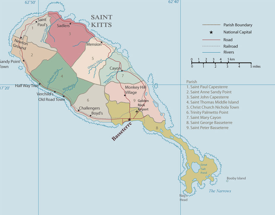
Interactive Map
Move your mouse over the red map markers to view information about each particular location. To read more, click the marker for further information. Locations may also be selected using the adjacent listbox.

Government Headquarters
Church Street
Basseterre
St. Kitts, West Indies
Tel: 869-465-2521 ext.1208
Website: www.nationalarchives.gov.kn
![]()
19 St. Clair Avenue
Port-of-Spain
Trinidad and Tobago
© Copyright 2018 National Archives, St. Kitts Nevis. All rights reserved.
Web Development: Genesis